Satellite Antenna Design
SatHunter
Calculate angles of satellite dishes. SatHunter is a program for calculating the orientation of a satellite antenna. SatHunter contains all the necessary information for adjusting the satellite antenna to the selected satellite. The adjustment is made
RF Toolbox X v.3.7.0
RF Toolbox is an antenna design and electronics calculation package for engineers, amateur (ham) radio operators, and other radio enthusiasts, as well as those in the communications professions.
Skyhopper v.1.0
Design Skyhopper antennas. Skyhopper is intended to help anyone intrested in designing Skyhopper antennas. The Skyhopper antenna was named after the first one was compared to a grasshopper. The antenna is basically a quad opened up on the bottom.
YAGI v.1.0
YAGI can help you to design multi element YAGI antennas. The yagi-uda antenna is the most recognized antenna. It produces maximum gain but requires tweaking for the number of elements. This software uses different formulae for 2,
PDLII v.1.0
PDLII is design for the Avanti PDLII Quad antenna. It enable you in designing and Avanti PDLII Quad antenna. The Avanti PDLII Quad (tm) of the 70s was known for its outstanding performance.
CAPACITORS v.1.0
Design capacitors for antennas and matchers. CAPACITORS calculate capacitance for different capacitors.
GAMMA v.1.0
GAMMA match your home-brew antenna. If you dont have the means for measuring reactance, resistance and capacitance on your antenna,
Feedlines v.1.0
Design feedlines with this application. Feedlines help anyone to design home brew feedlines and hardlines.
VERTICALS v.1.0
Learn about common antenna types.
Seven Element Quad Calculator v.1.0
Helps in designing quad antennas.
Antenna v.4.0.0.543
Antenna helps you create a good design for your website so that it looks great and professional. This software will help you to create your own web pages and image galleries in a cinch.
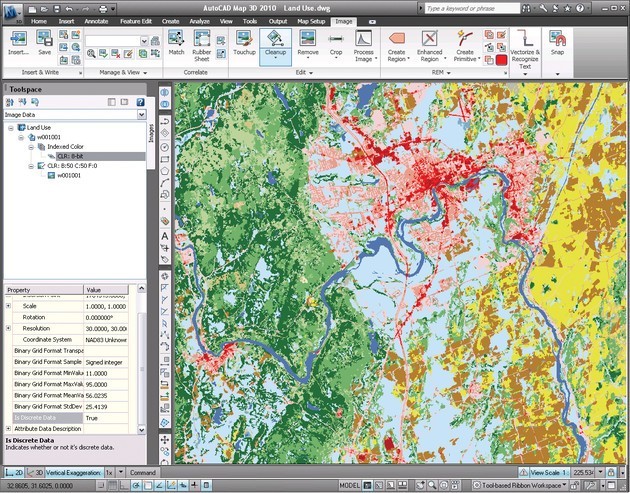
AutoCAD Raster Design v.2013
Get More Value from Your Raster Imagery Make the most of raster images, maps, aerial photos, satellite imagery, and digital elevation models.